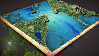
Here's how to make a 3D diorama micro world sort of thing for the Straits of Mackinac. Plus a little bit of Nelson nostalgia thrown in!
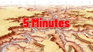
Colorful 3D mountain diorama:
https://youtu.be/kVsj6Z7UuLY
Undersea 3D diorama:
https://youtu.be/ehJhR3lgjNw
Fake 3D atmosphere :
https://youtu.be/g7eS2K2lGCg
Here's the World Imagery Wayback app to get archived versions of the imagery basemap: https://livingatlas.arcgis.com/wayback
Source elevation/bathymetry data from the Great Lakes Environmental Research Lab: https://www.glerl.noaa.gov/
Michigan GIS data portal: https://gis-michigan.opendata.arcgis.com/
This demo is an extract from a presentation given at the IMAGIN annual conference of lovely Michigan map nerds. https://imagin.org/
More work from Tau Rho Alpha: https://www.davidrumsey.com/luna/servlet/view/all/who/Alpha%252C%2BTau%2BRho/what/Geology/
00:00 Intro examples
00:24 Nelson nostalgia and diorama intro
02:08 Finding and clipping an elevation model
3:10 Lets go 3D!
4:16 Finding better archived imagery
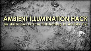
5:04 Hillshade!
5:29 Water and watery effects
8:38 Arranging a layout and perspective
9:14 Drawing and styling the dirt curtains
11:34 Sneaking in an easter egg
12:48 Labels and title
14:07 Adding a locator map
Check out some other social channels where I share how-to's and updates on random map adventures:
http://adventuresinmapping.com
https://www.esri.com/arcgis-blog/author/j_nelson/
https://twitter.com/John_M_Nelson
https://www.instagram.com/johnmnelson/
https://www.linkedin.com/in/johnmnelson/
 5:37
5:37
 22:43
22:43
 13:30
13:30
 28:39
28:39
 15:52
15:52
 12:17
12:17
 22:12
22:12
 16:55
16:55
 18:58
18:58
 10:40
10:40
 5:32
5:32
 25:54
25:54
 21:26
21:26
 17:18
17:18
 19:34
19:34
 19:41
19:41
 7:17
7:17
 59:18
59:18
 22:52
22:52
 11:40
11:40


